
SCAN TO BIM


Let your creativity
Fly with BIM


Precision and Accuracy
Use our 2D or 3D digital maps and models – accurate to within millimeters – to survey and measure from your desktop
Fast Delivery
Get your measured 2D and 3D models fast so you can keep your project schedules.
Reduce Costs
Avoid the cost of clashes, change orders, equipment rentals, and the project delays that come with them.
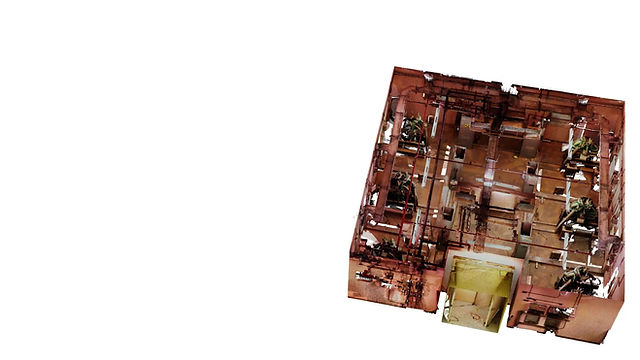
The scan-to-BIM process swiftly converts the visual and spatial aspects of a building or site into a comprehensive model packed with actionable data within hours. This positions it to replace numerous conventional building tools, such as the humble tape measure. Scan to BIM shares similarities with 3D photogrammetry and, depending on the model's experience, is associated with augmented reality (AR).
The resulting point cloud holds vast data, with scanners collecting millions of points per second. Lidar is the primary method, while some scanners utilize SLAM algorithms for simultaneous mapping and localization.
Scan-to-BIM translates laser-scanned, point-cloud models into BIM platforms, integrating data for development, design, and construction teams. These models provide visual accuracy and spatial awareness, aiding in site documentation and infrastructure understanding for new construction and renovation projects. Automating documentation streamlines processes and enhances project efficiency.


Connecting Possibilities
Capturing Reality, Building Virtually
HOW SCAN TO BIM WORK
Turning Scans into Structures

In the realm of Building Information Modeling (BIM), accuracy stands as a cornerstone for efficient project delivery and lifecycle management. BIM facilitates the creation of detailed digital representations of physical

infrastructures, offering a holistic view of a project's components and interrelationships. Ensuring precision within these models is imperative, as inaccuracies can lead to costly errors during construction and maintenance phases. Leveraging BIM-related accuracy entails meticulous data collection, validation, and modeling processes, often supported by advanced technologies like laser scanning and point cloud processing.

Through rigorous quality control measures and collaborative efforts among stakeholders, BIM accuracy not only enhances design visualization and clash detection but also enables informed decision-making and streamlined project workflows. Ultimately, the pursuit of accuracy within BIM fosters efficiency, cost savings, and sustainability across the built environment.
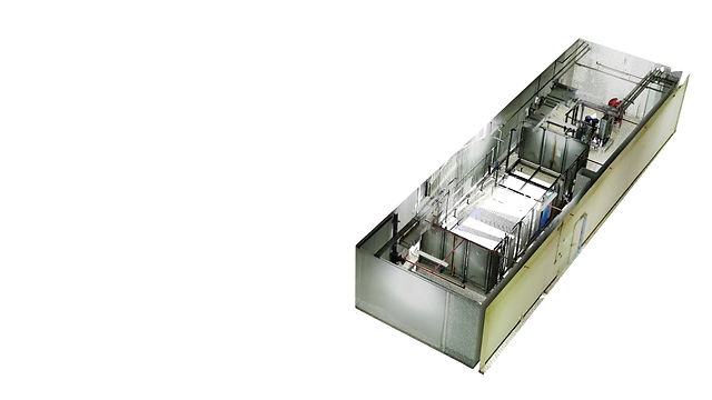
Harnessing state-of-the-art design and engineering software, we seamlessly mold the future on our platform, digitally transforming point cloud scans into precise models, driving innovation forward.


CREATING AND USING THE MODEL
Transforming Reality into Digital Intelligence
Millions of points define every surface, requiring manual or automated interpretation for usability. Some tools enable tracing over point clouds for custom detailing, while others automatically analyze geometry. Autodesk ReCap Pro interprets point cloud data for use in Revit.Importing a point cloud into design software like Revit necessitates critical data cleaning to eliminate errors. The 3D scan-to-BIM workflow culminates in a metadata-embedded point cloud accessible to design and construction teams for planning and revisions.
Scan-to-BIM enhances speed, accuracy, and workflow in design and construction. It aids clients in site assessment, teams in site selection and zoning management, architects in design refinement, and builders in progress monitoring. These scans, taking mere hours to gather and interpret, offer flexibility for repeated use during construction. The ease of scanning aids facility maintenance crews in inspecting and identifying repairs, especially in challenging or hazardous locations.

